The Forest Practice Code of British Columbia specifies that bridges and culverts for permanent forest roads shall be designed for Q100, the 100 year instantaneous peak flood. For culverts, the peak water level must be no higher than the top of the culvert. This is quite conservative and, presumably, it is intended to allow for sediment and floating debris that are difficult to take into account explicitly. If Q100 actually were to occur on a stream, probably all of the culverts on it and most of the bridges over it would fail. It is important that designers consider the consequences of failure to both the road link and to the environment and design their stream crossings to minimize the adverse effects of failure, in addition to the requirement that they be able to carry Q100.
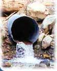
The Forest Practices code suggests that small culverts be sized to have 3 times the cross section area of the stream below the high water mark. This again is conservative, but it has the virtue of relating to the actual stream in question. For larger culverts and bridges, consultants are free to use their own methods, but a good ball park check is that the culvert/bridge cross section area should be in the range of 1.5 to 3 times the cross section area of the stream below the high water mark.
Due to the high variability in unit flows (flows per unit area) across the province, the mountainous topography and the scarcity of stream gauges and rain gauges, the standard methods simply cannot provide the desired accuracy. For example, on Vancouver Island, unit flows vary by more than an order of magnitude, yet there are less than 50 stream gauging stations and only a handful of tipping bucket rain gauges that could provide the type of data required for conventional analyses. However, unlike unit flows, the co-efficient of variation of annual flood peaks falls within a fairly narrow range and this results in a multiplier of between 2.4 and 3.0 for the ratio of Q100 to Q2 (the mean annual peak flow). The co-efficient of variation is the standard deviation divided by the mean and it is directly related to the ratio of Q100 to Q2.
We recommend that forest companies measure peak flows in their areas by recording peak water levels upstream of existing culverts that have entrance control (the preferred method) or in the natural channel. The corresponding peak flows can then be computed from the peak water level and the culvert diameter, in the case of culverts or from the peak level and measured data on the natural channel cross section. We recommend simple peak water level gauges, as it is difficult to find reliable evidence of peak water levels after the event. This web site provides a way of calculating the flow corresponding to the peak water level, given only the water level and the culvert diameter. It also provides ways of calculating the flow in natural creeks by both Mannings formula and by assuming near critical flow for the case of tumbling flow. We found that unit peak flows do not seem to vary much with drainage area, but since it seems to be generally accepted that unit flows should increase with decreasing watershed area, we are recommending that flows be assumed to vary with the drainage area raised to the 0.8 power. The value of 0.8 is rounded from 0.785, which is used by the BC Ministry of Environments Hydrology Division. Q2 =K1A 0.8 , where K1 is a constant for a particular region and A is the drainage area of the stream in question, in square kilometres.
The web site provides a map showing the ratios of peak flows in recent years to long-term average peak flows (Q2) for each region. These ratios will be calculated from Water Survey of Canada data when available and provided on the web site. This will allow estimation of Q2 given a peak flow measurement last year. There is also a map showing the ratio of Q100 to Q2 for each hydrologic zone and this data can be used for estimating Q100. We recommend use of the formula Q100 = K A 0.8 for estimating design flows for culverts and bridges within the region. Once K has been determined, it is only necessary to measure the watershed area of a stream and then use the formula to compute Q100.
We also recommend a reality check that the culvert/bridge cross section area should be between 1.5 and 3 times the cross section area below the high water mark, of the stream, being crossed.
We have checked out possible complications such as the existence of different populations of flood events in a single area such as fall rain floods and spring snow melt floods but they do not seem to make much difference.
This approach seems suitable for Forestry companies, who have tenure in a specific area and hence, a continuing interest in appropriate design. Obviously, they should pass on their data to any consultants they engage, who can check the results against their standard methods.
Assume that a peak stage gauge has been installed, upstream of a 1.0 metre diameter culvert on Creek X in Zone 5 and in the winter of 2000 - 2001, a peak water level of 0.6 metres above the invert of the culvert is recorded. F, the ratio of long-term average peak flows to peak flows in the winter of 2000 2001 in Zone 5 is 1.25. This value is obtained from two long-term Water Survey of Canada "index" gauges in the zone. M (the ratio of Q100/Qa, where Qa is the long term average peak flow) is 2.8. The watershed area of Creek X at the gauge is 4.5 km2 . Qm, the peak flow corresponding to the measured peak water level of 0.6 m is 0.409 m3/s (cubic metres per second). K1 = Qm/A0.8 = 0.123. Ka = F K1 = 0.154; and K = Ka M = (0.154)(2.8) = 0.43. Thus for the region, in which this gauge is located, Q100 can be estimated, for any particular location from the formula Q100 = 0.43 A0.8 , where A is the watershed area of the creek at the point where Q100 is required.